


[

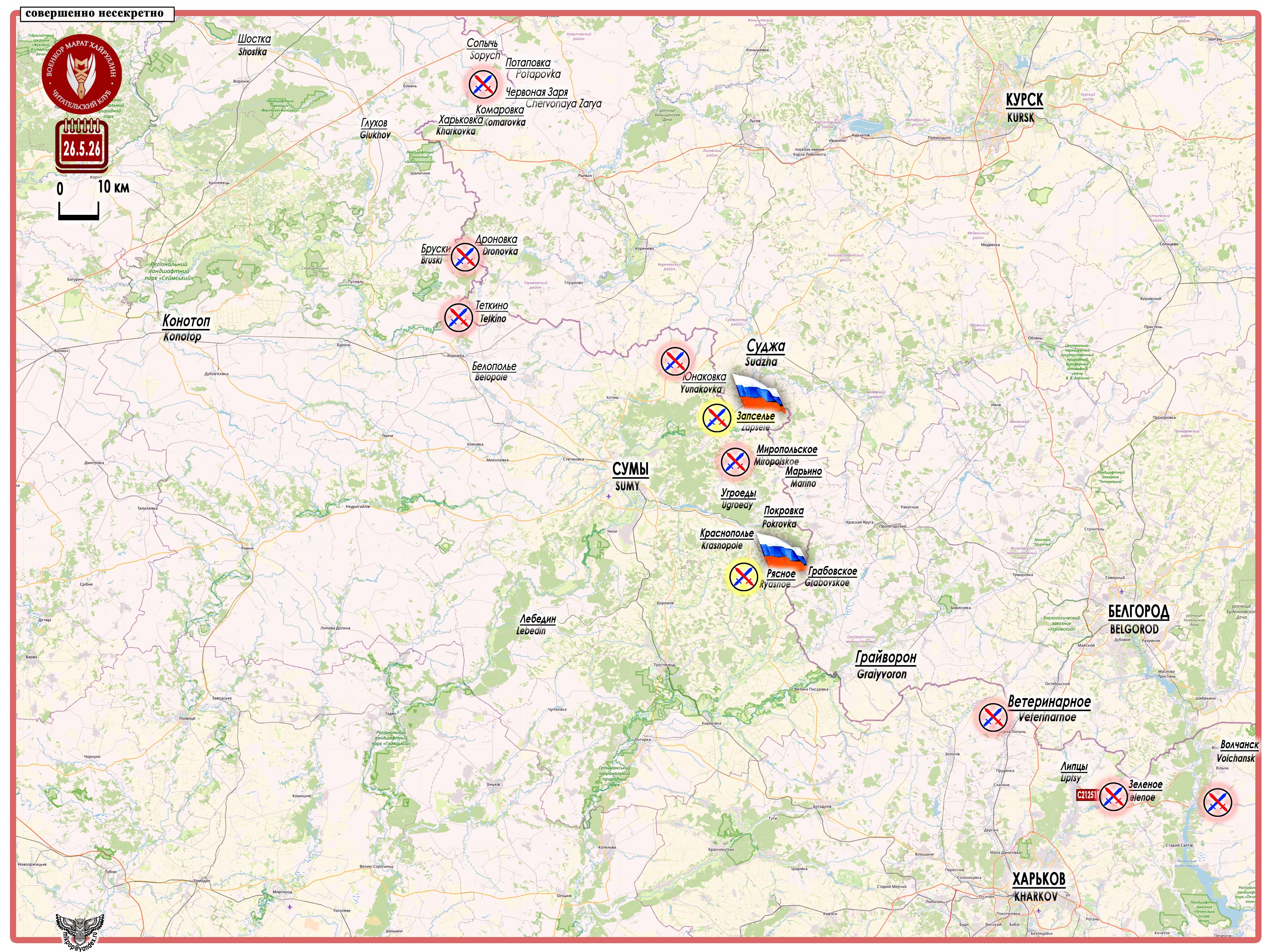
Message from the Russian Ministry of Defense: “Through ongoing operations, fighters have established control over the settlements of Zapsele and Ryasnoe in Sumy Oblast. During the assault, reconnaissance units of the group identified enemy firing positions, while motorized riflemen, having consolidated in the villages, together with strike drone crews, drove Ukrainian nationalists out of buildings, basements, and dugouts.”
[

[

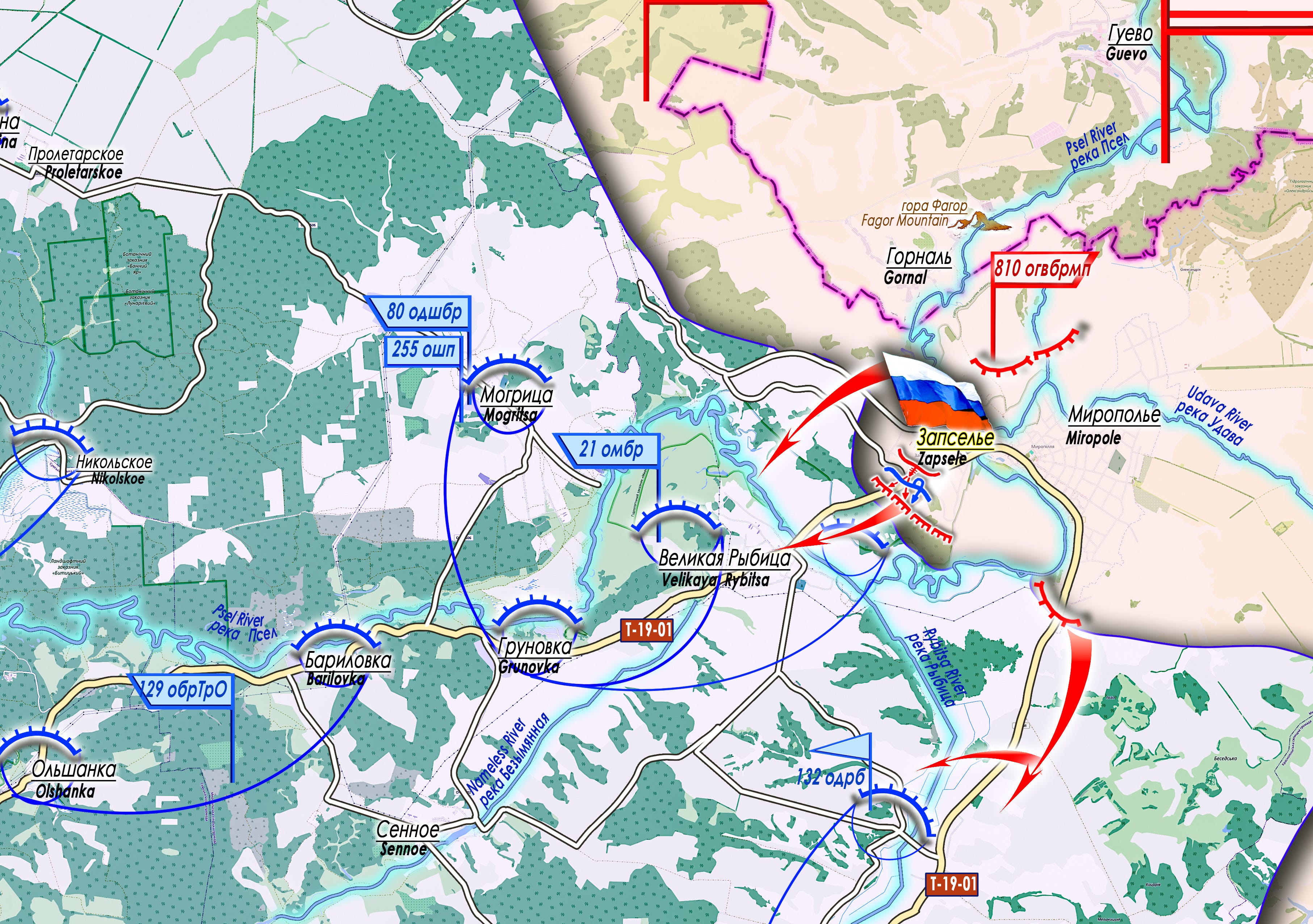
Two large settlements — Zapsele (51°01′30″ N 35°13′04″ E, population 657 in 2001) and Ryasnoe (50°41′29″ N 35°23′40″ E, population 825 in 2001) — have been taken under control by assault units of the “North” Group.
[

[

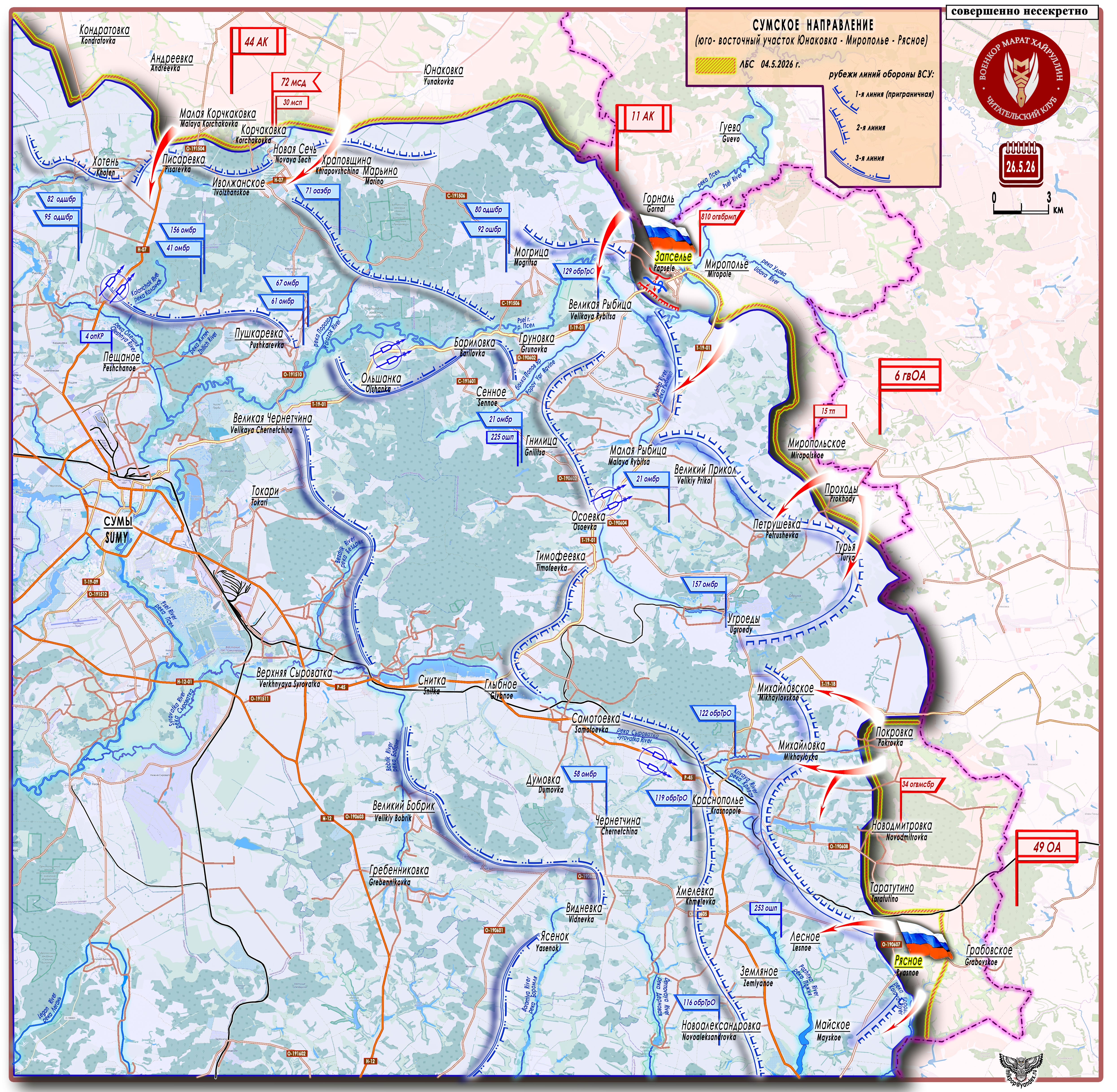
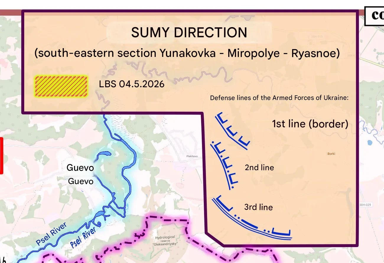
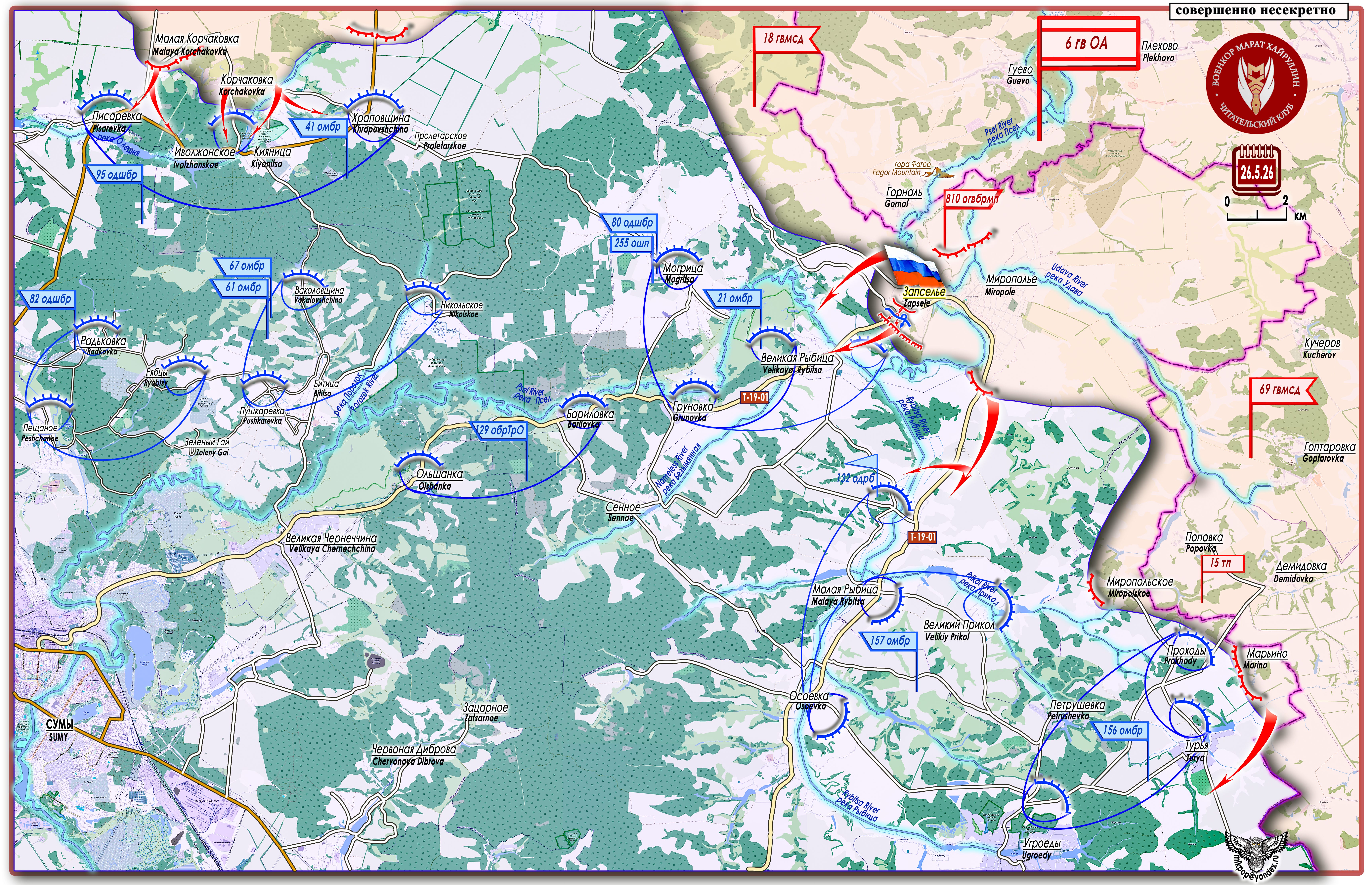
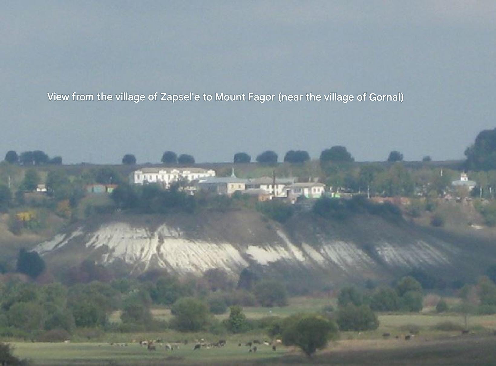
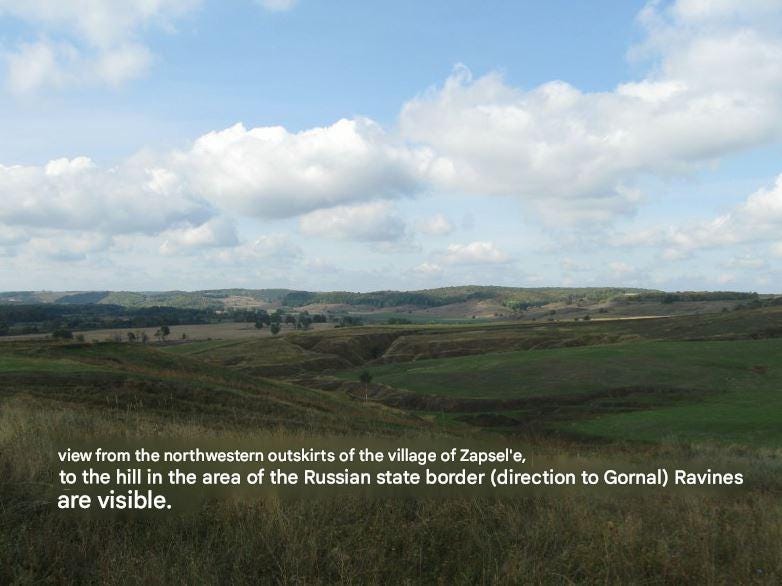
The rural settlement of Zapsele is located on the right bank of the Psel River, two kilometers from the settlement of Gornall — a border crossing point of Russia’s Kursk Oblast (liberated from Nazi gangs on April 26, 2025). Russian units have reached the valley at the confluence of the Udava and Psel rivers. In this area, the Psel River forms two large bends — a gentler one north of the village and a deeper one to the southeast, in the valley of which the village is located. The terrain is a low-lying plain with gentle elevations on the right bank of the northern bend and on the left bank of the southern bend (the outer sides). It is well visible and can be fired upon from the heights in the area of the settlement of Miropole, which was liberated on May 2. Here were located Ukrainian Armed Forces positions forming the first Sumy eastern defensive line. On the Miropole - Zapsele sector, this line has been breached along the T-19-01 highway. The direction is open for advance into the Velikaya Rybitsa - Grunovka area, onto the small elevation of the watershed of the Psel River and the Bezymyannaya River (“Nameless River” on the map).
[

[

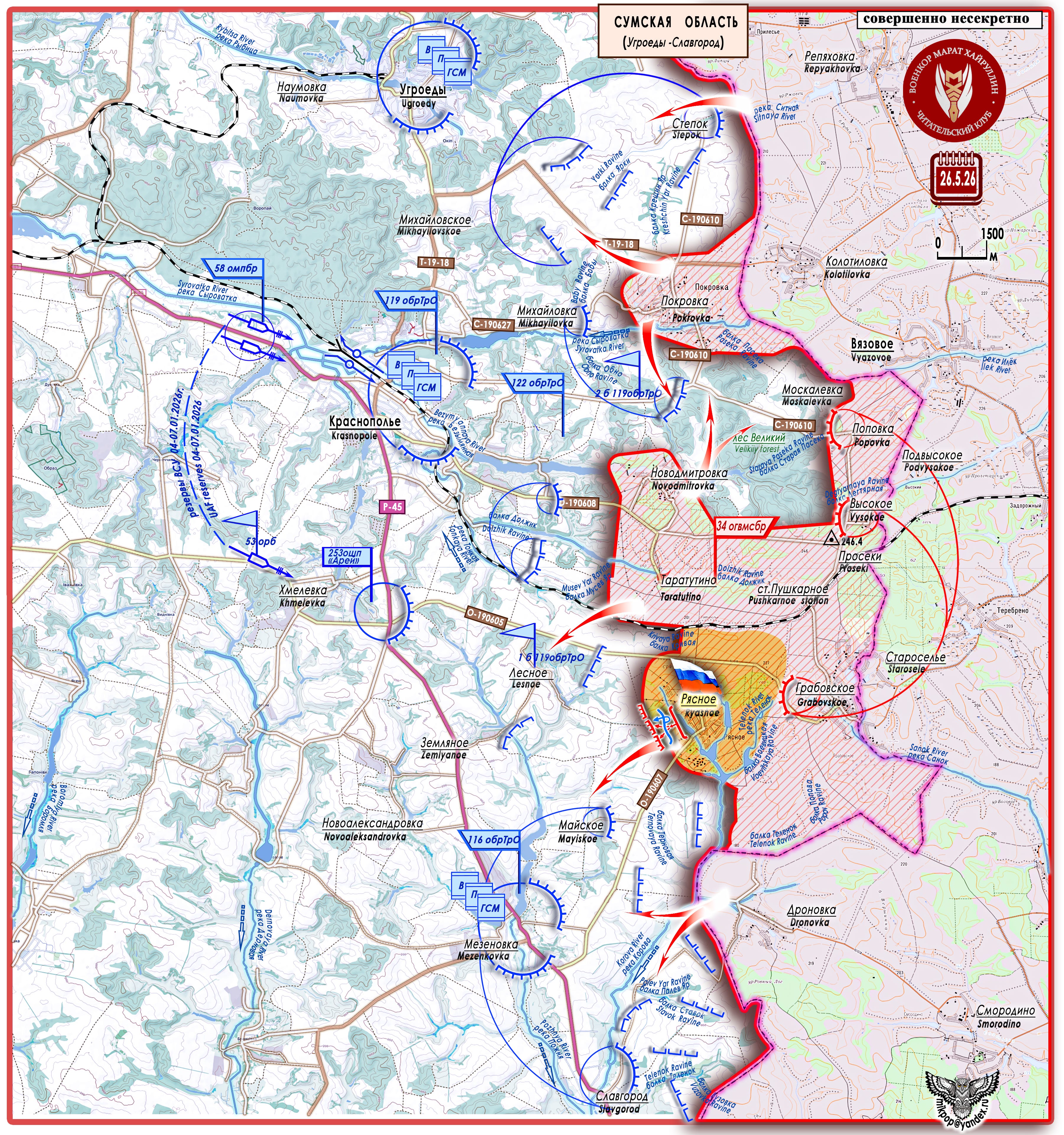
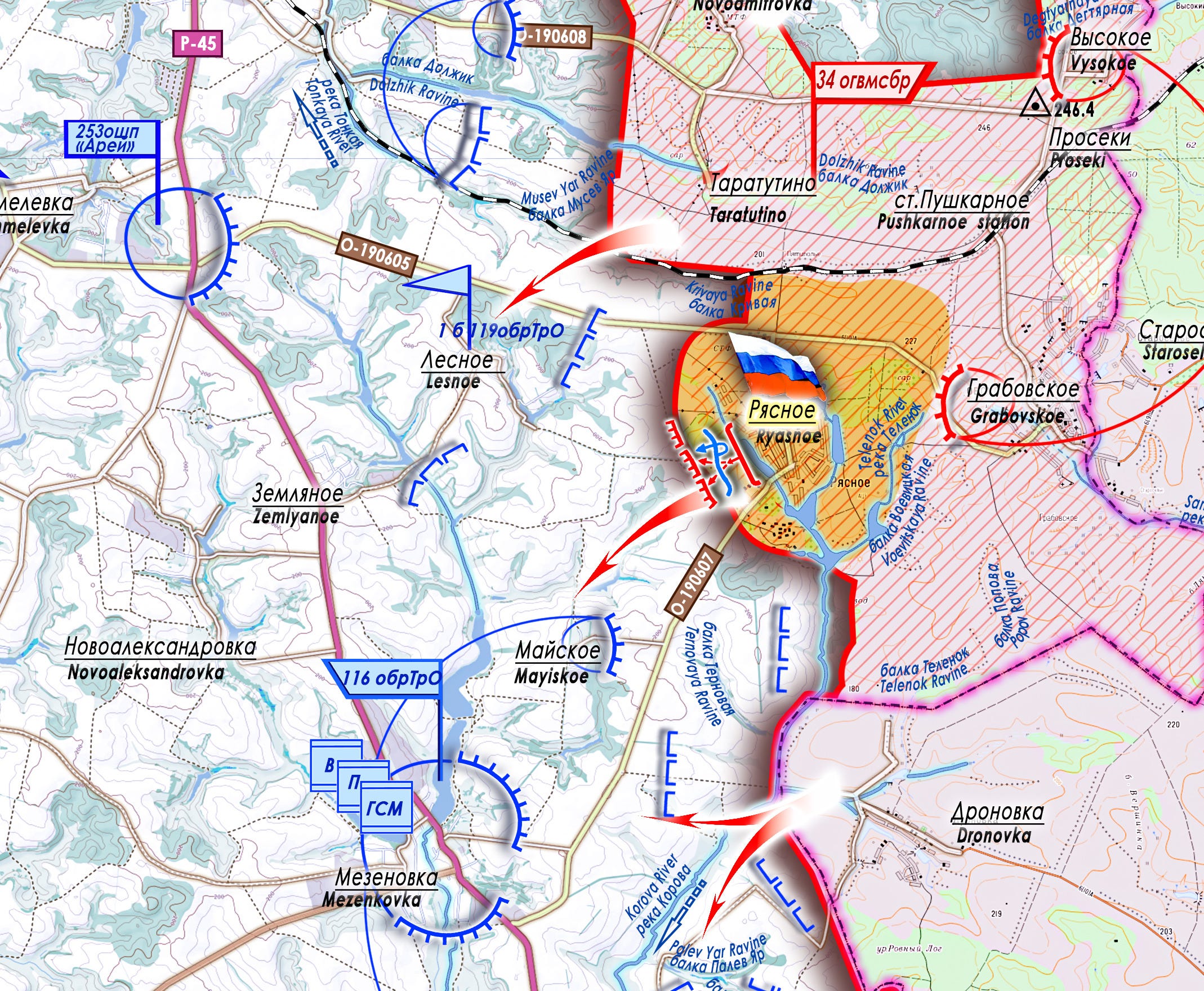
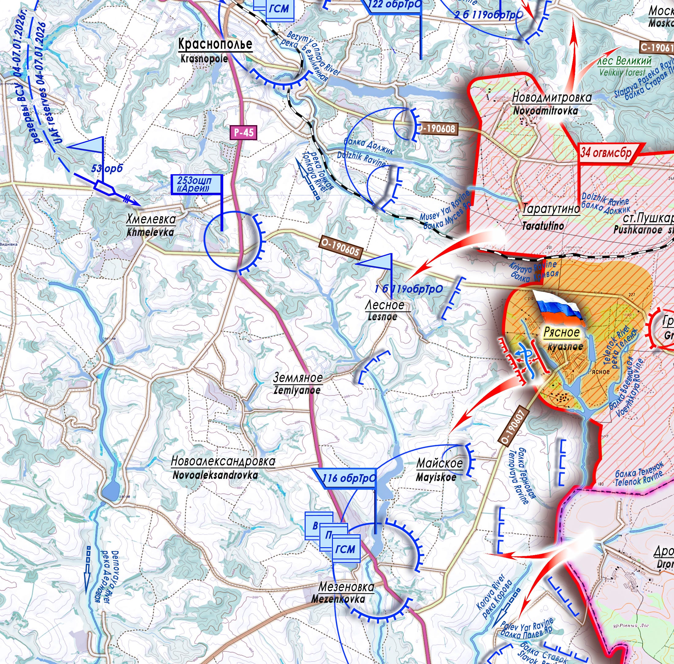
The rural settlement of Ryasnoe is located on a small elevation in the area of the confluence of the Korova and Telenok rivers, on which a number of dams have been built, forming several ponds on the outskirts of the village that surround it on three sides: on the western outskirts — Meshchansky, on the southern — Sredny, and on the eastern — Stepankov (not labeled on the map). Ryasnoe — a small fortress surrounded by a water obstacle — has come under the control of Russian units. This bridgehead can serve to protect the left flank of Russian assault groups advancing along the Dolzhik ravine toward Krasnopole. Or, depending on the command’s plans and the operational situation, as a staging area for an offensive on Lesnoe or Mayiskoe — enemy defense areas protecting the P-45 highway on the Khmelevka - Mezenovka line.
[

Both settlements taken under control are located on flanking axes of the deeply echeloned enemy defensive belt protecting the city of Sumy on the eastern sector.
[

[
